
 Approximate driving time with sightseeing
 Highest point
 Lowest point
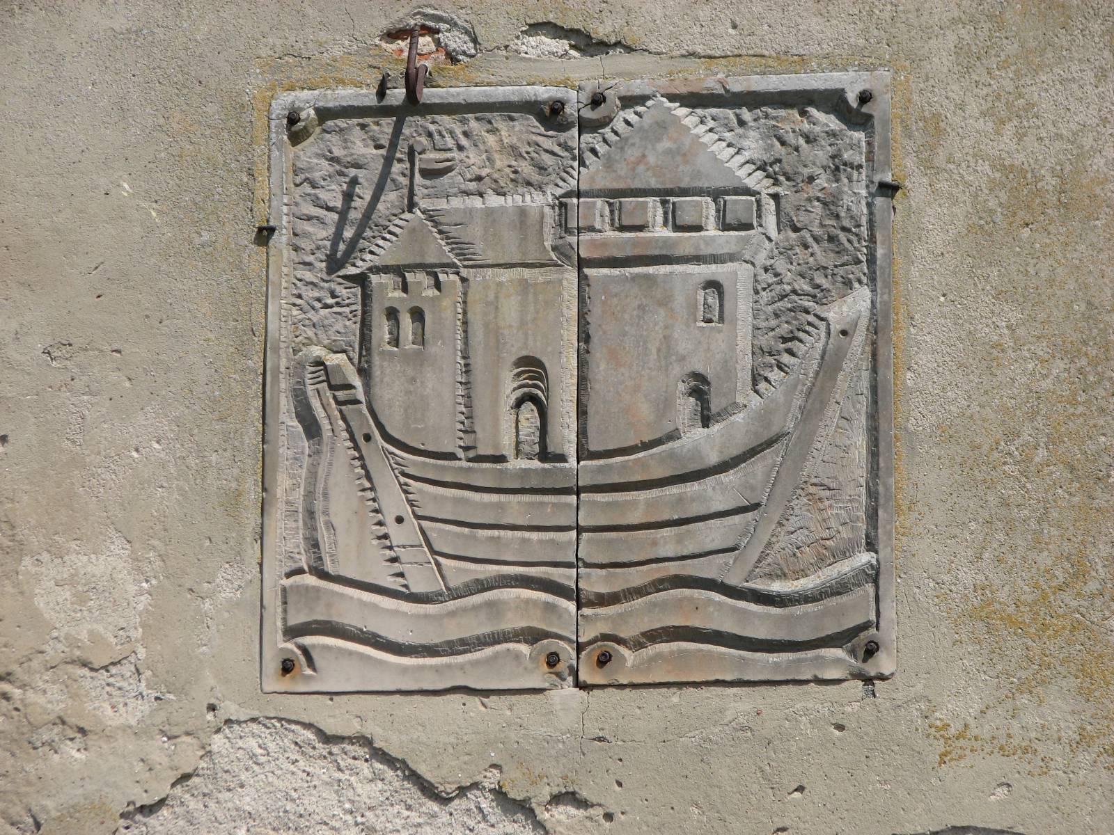
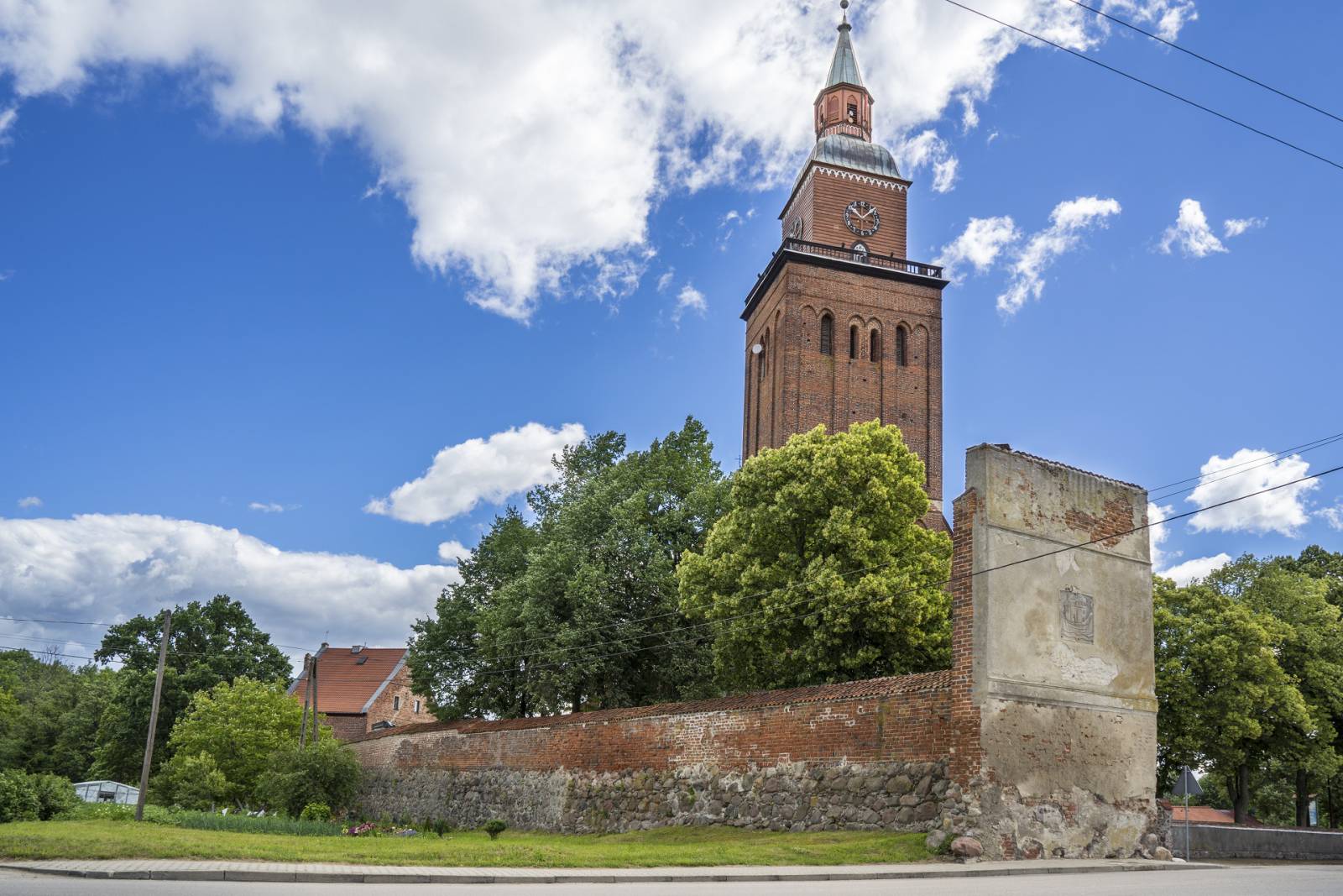
The trip starts in Sępopol – a town located on the bend of the Łyna, at the point where it is joined by the Guber river. On the tower of the local 14th-century church, a viewing terrace is available, and inside the tower there is a museum exhibition concerning the history of the town and the region. When leaving Sępopol, it is worth noting the preserved fragment of defence walls containing the town crest. The first section of the trail leads to the Liski village. A Trakehner horse stud is situated here. The large courtyard is surrounded with farm buildings and the administrator’s manor house. The history of the horse stud dates back to 1740. After the war, the horse-breeding tradition was continued in Liski; for many years, it was the biggest horse stud in Poland. It is also worth noting houses adjacent to the horse stud and the former school. Then the trail leads from Skitno to Judyty. On the village premises, there is a neo-classicistic palace & park complex established in 1863. Today the site is a private property. In 1928, Eberhard von Kuenheim was born here; from the 1970s till the 1990s he was the chief executive officer of BMW. From Judyty the trail leads farther to Szczurkowo – a village situated near the border. In 1945, the village was divided by the Polish-Soviet border. Its part on the Russian side included the church and the palace, which have not survived until today. In the outskirts of the village, there is a milestone – a sign with information about the distance to Königsberg, which was placed there in the 1st half of the 19th century. The land is also one of the places where storks’ nests occur most frequently. Farther, along the Polish-Russian border, the trail leads to Ostre Bardo. The borderland village is inhabited to a large extent by the Ukrainians who were resettled here from Bieszczady in 1947. In Ostre Bardo, there is a 16th-century late Gothic church, which currently serves as a Greek-Catholic church. In Stopki – a village situated on the Łyna – you can rest by the river, which forms a large marsh at this point as a result of an eddy caused by the dam of the water power plant built in Friedland (today Pravdinsk) in the 1920s. It is the biggest water power plant on the Łyna; it is situated on the Russian side. On the Polish side, eight smaller power plants operate on the river. From Stopki, the trail leads through Długa back to Sępopol.
Surface and marking of the trail:
MARKED TRAIL
The most part of the trail runs on asphalt roads; on the section from Skitno to Judyty, a concrete slab pavement appears. Between Bartoszyce and Friedland, the trail leads along the former railway tracks. The trail overlaps with the red PTTK trail.
Attractions on the trail:
- Church of St. Michael the Archangel in Sępopol
- Fragment of defence walls in Sępopol
- Horse stud in Liski
- Palace & park complex in Judyty
- Greek Catholic Church of the Birth of the Blessed Virgin Mary in Ostre Bardo
Course of the trail:
- 0 km – Sępopol
- 7 km – Smolanka
- 7 km – Liski
- 3 km – Kolonia Skitno
- 0 km – Szczurkowo
- 8 km – Ostre Bardo
- 0 km – Stopki
- 2 km – Sępopol
Tourist Information Point in Bartoszyce
- Bohaterów Warszawy 96, 11-200 Bartoszyce, phone 89 76 29 880
pit@bartoszyce.pl, www.gci.bartoszyce.pl