
 Highest point
 Lowest point
 Sum of driveways
 Sum of downhill
 Connected with GreenVelo
 Slope
Slope Marking
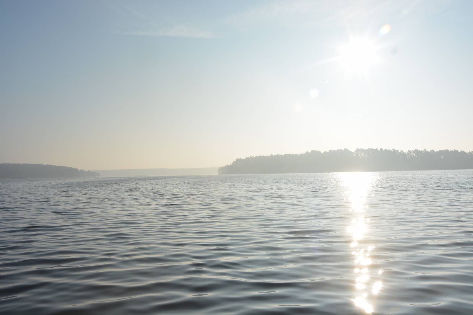
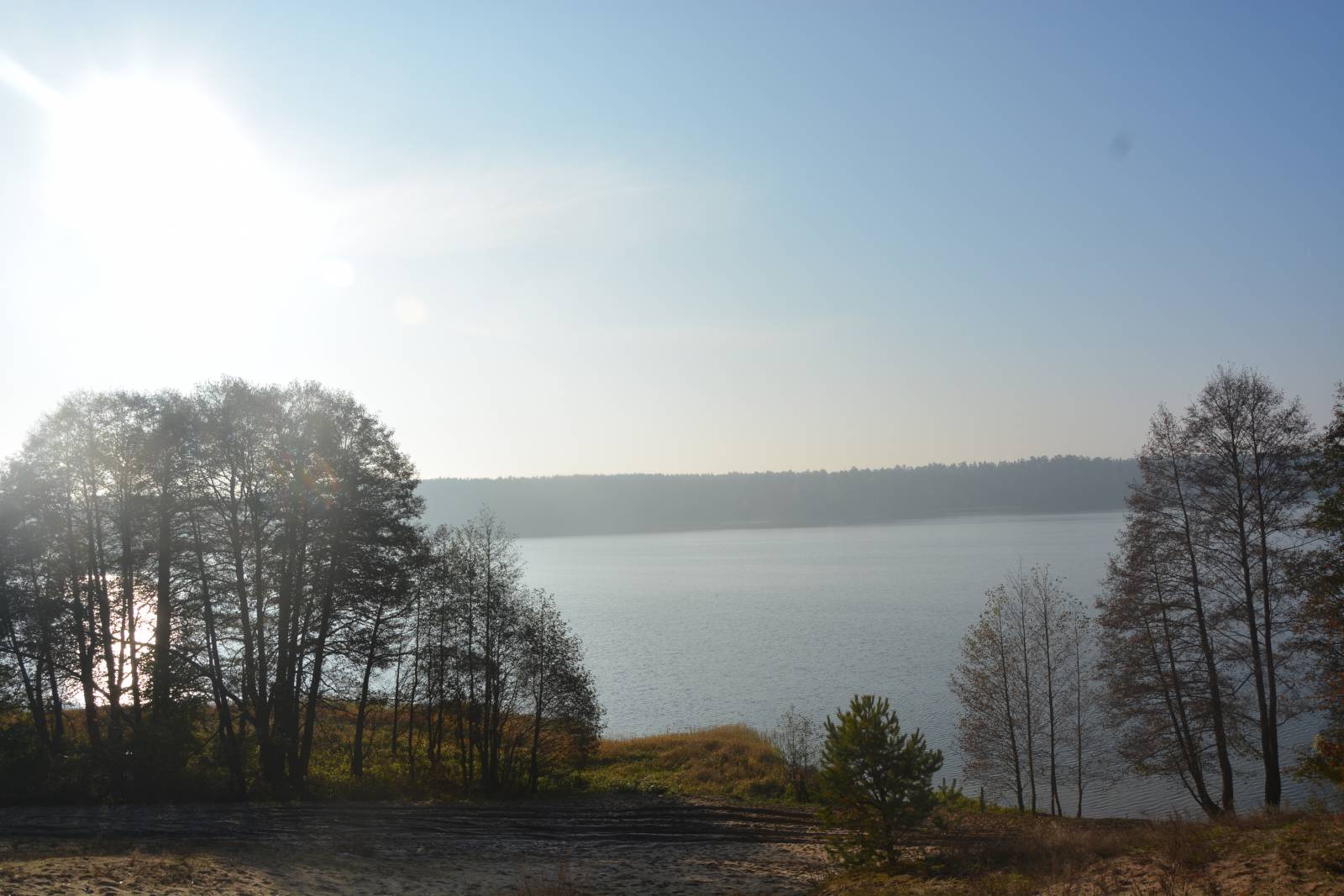
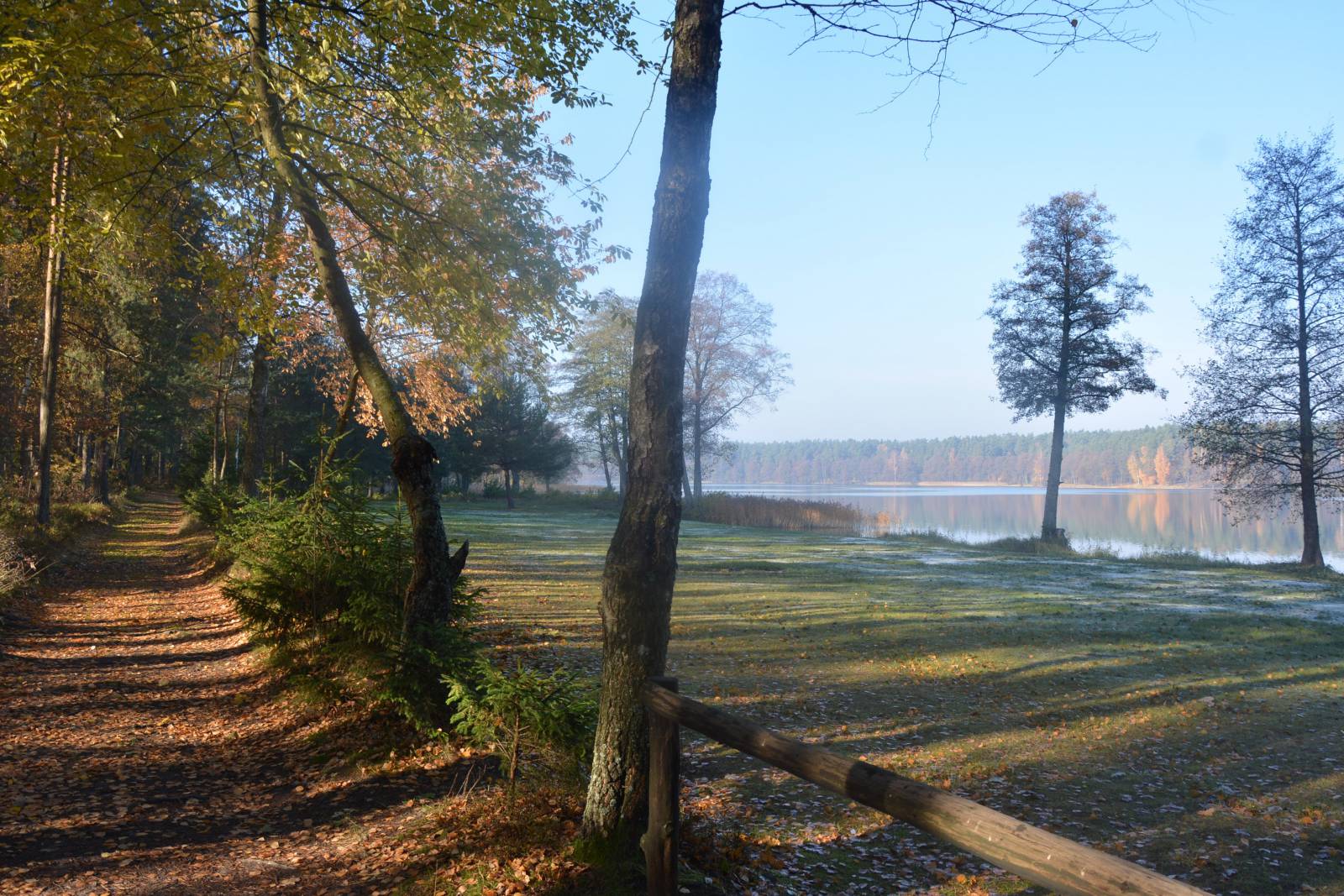
The Around the Białe and Studzieniczne Lakes Bike Trails runs, as its name suggests, around these lakes. The lakes are located north of the city of Augustów and are part of the hydro-technical system of the Augustów Canal. The route is in the form of a loop; it is signposted in blue and is 25 kilometres long. It is great for a family recreational trip. It runs mainly through forest roads on the lakesides and a fragment of the city of Augustów. The attraction of the route are lovely views of the lakes, two locks of the Augustowski Canal (Przewięź and Swoboda) and the Marian sanctuary in the locality of Studzieniczna. The trail is quite well-signposted and equipped with resting places. There are numerous bars and restaurants on the route.
The general course of the trail is as follows: Lake Białe, around the bridge on Klonowica (0.0 km) - Przewięź, lock on the Augustów Canal (7.4 km) - Swoboda Lock (12.0 km) - Studzieniczna, Marian sanctuary (15.9 km) - national road no. 16 (16.8 km) - Wojciech (18.6 km) - Augustów, start of the cycling route (20.1 km) - Augustów, the railway station (22.0 km) - Klonowica, the bridge (24.6 km) - the start of the route (25.0 km).
The trail starts behind the bridge on the Klonownica river. This is known as the shortest navigable river in Poland (counting according to different sources from 550 to 800 m), connecting Lake Necko with the nearby Białe Augustowskie Lake, thus creating a continuation of the Augustów Canal. The adjacent Lake Rospuda, actually part of Lake Necko, is the last stretch of the 70 km long, popular Rospuda water trail for kayaking.
The trail delves into forests on the northern shore of the Lake Białe for over 7 kilometres and runs to the village of Przewięź, in which there is one of the historic locks of the Augustów Canal, built in 1827. From here the trail runs further through the forests to the east, this time along the north bank of another lake called the Studzieniczne Lake, to the next canal lock – the Svoboda Lock. This one also dates back to 1827 and is the last of the locks in the Augustów area. It is one of 18 locks built on the entire length of the Canal (currently 14 locks are located within the borders of Poland). It was destroyed during the war, so the appearance of the gate differs from the original. It is worth paying attention to the buildings next to the lock. At each lock, wooden buildings were built for the lock operator.
The canal continues east, towards the border. The Green Velo route also runs there, along with which the blue route turns back to the city of Augustów, this time the southern shore of the lake. The route runs to the village of Studzieniczna, where the Marian sanctuary is a must-see monument on the lake island. Next to the chapel there is a well with "miraculous" water and a statue of the Pope John Paul II. From here the blue trail is accompanied by the signs of the Green Velo connector route and both routes lead to the city of Augustów. In the vicinity of the railway station, the route runs on a new cycle road, and then turns back to the bridge over the Klonowica river, where the start of the route is located. The Augustów centre is located less than 3 kilometres southwest of the railway station.
The trail, as its name suggests, runs around the largest reservoir of Żuławy Region, which is Lake Druzno. It is difficult to determine accurately the surface area of this shallow reservoir, located near sea level, but it is over 1000 hectares. This lake is a sanctuary for mud birds, and the Elblag Canal trail runs through this lake. The trail starts near the second largest city of the Warmińsko-Mazurskie Province, Elblag. The name of the area, Żuławy Elbląskie, comes from the name of this town. The route starts in the immediate vicinity of the lowest point in Poland, which is the village of Raczki Elbląskie. At this point, the ground is almost 2 meters below the sea level, so you can jokingly say that it is "depressing". The trail runs through a typical Żuławy landscape, which is as flat as a table. On the route you can see a few historic arcaded houses, built by the former Dutch settlers living in these areas, called Mennonites. In addition, the attractions include the views of the lake itself, especially interesting for bird lovers. The route ends in the village of Komorów Żuławski next to national road no. S7 leading from Gdańsk to Elbląg, on the edge of the Elbląg Upland. From there, the you can return safely to the city of Elbląg using the former no. 7 national road. The characteristic feature of the route is the pavement on the roads made of multi-hole reinforced concrete JOMB slabs – also called "jumbachs", which are used to pave roads in the Żuławy region that run through the swamps. Due to the waterlogged nature of the area, some of the slabs collapsed, which makes cycling along the trail quite bothersome. For this reason, the mountain bike is recommended for the trail with good cushioning. The trail runs through open, treeless areas typical for the Żuławy Region, so on windy days one should expect an additional nuisance due to the wind. There are numerous information boards on the route, and the signposting is very good. On the way, you can buy basic food products in small village shops. This route is recommended to lovers of architecture and the landscape of the Żuławy Region, who are not afraid of the road surface, which may be hard at places to cross.
Points of interest along the trail:
- The city of Augustów - monuments, the Augustowski Canal, port, Museum of the Augustów Canal, tourist attractions
- Studzieniczne and Białe Lakes
- The Klonownica River and the Augustów Canal
- The Przewięź lock
- The Swoboda Lock
- Marian Sanctuary in the village of Studzieniczna
The entire trail is suitable for bicycles with panniers/bike trailers. The trail uses solely roads with no motor vehicle traffic allowed or local roads with a low and very low vehicle traffic; no dangerous intersections. A recreational trail.
Starting point:
A branching off of the roads about 400 meters north of the bridge over the Klonownica river, national road no. 8
Finishing point:
A branching of the roads about 400 meters north of the bridge over the Klonownica river, national road no. 8