
 Highest point
 Lowest point
 Sum of driveways
 Sum of downhill
 High slope sections
 Slope
Slope Marking
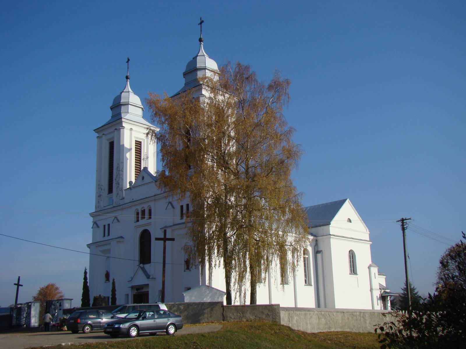
The Krzywe-Kaletnik Yellow Trail is a walking trail, but it is open for cyclists and accessible for tourist bikes. It is 16.5 kilometres long and runs almost entirely through the forests of the northern part of the Wigry National Park. The route is picturesque and well-signposted (mainly hiking trails, yellow). It requires some skills in off-road cycling, because at some places the trail meanders on narrow paths and climbs wooden bridges and footbridges. It's a great forest route with lots of picturesque spots. Spruce forests, mid-forest lakes and hilly areas make it one of the most beautiful trails of the Suwałki area. It starts in the large village of Kaletnik, reminiscent of a small town, whose landscape is dominated by the massive body of the neoclassical church dating back to the early twentieth century. This village is located on the northern edge of the Wigry National Park.
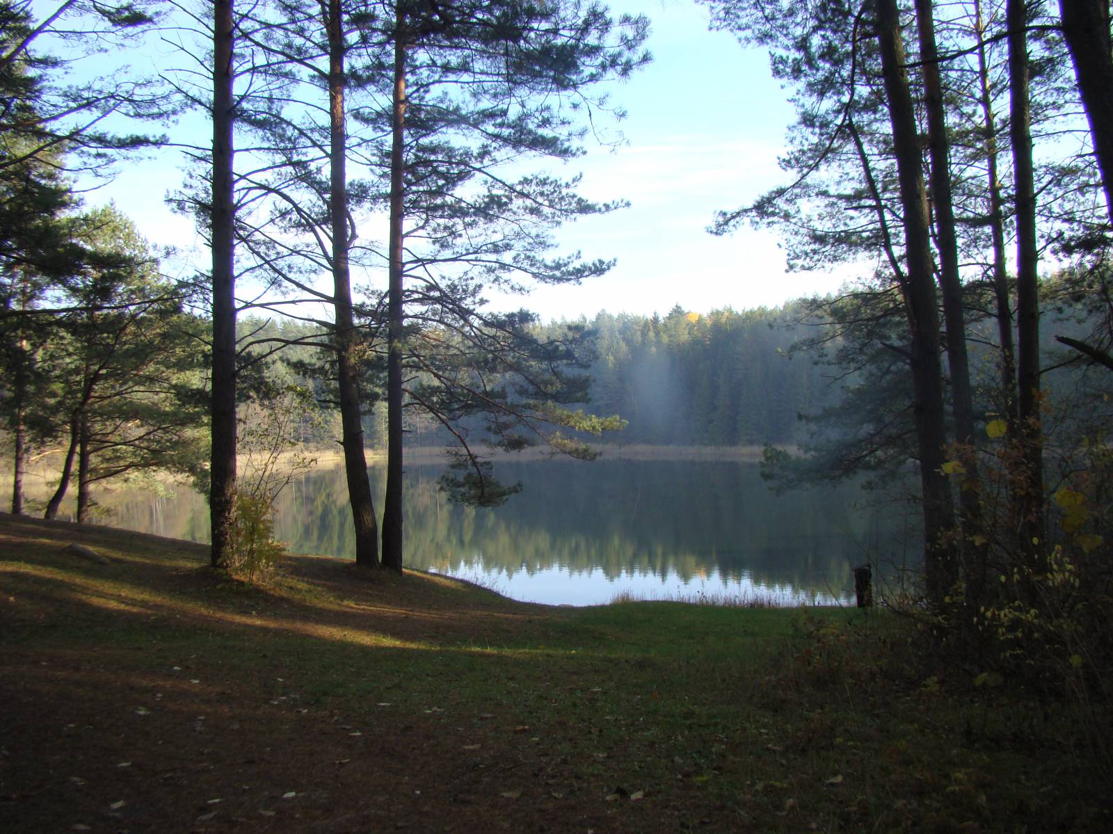
Further down the route, as described on the Park’s website, the trail runs through strongly undulating moraine areas, peat bogs and fresh forests, showing picturesque mid-forest lakes (Samle Duże, Samle Małe and Gałęziste) and the lovely Wiatrołuża and Kamionka rivers. The route ends in the village of Krzywe. The management office of the Wigry National Park, established in 1989, is located here. It houses a tourist information desk and a natural exhibition presenting the flora and fauna of the Park. Near the Management Office, in the former forest administration region building, there is a small ethnographic exhibition. There are also three educational paths.
In the vicinity, in the territory of the National Park there are five charming melancholic lakes, known more precisely as “dead-ice” lakes. Such a name is given to small, mid-forest lakes surrounded by peat bogs, which have dark brown water, very acidified by decaying vegetation remains. On the route there are wooden walkways crossing peat bogs, an umbrella roof and a vantage point that is an excellent place for watching water birds and beavers.
Points of interest on the trail:
- Kaletnik – a neoclassical church
- The Wigry National Park - forests, lakes, nice views
- Krzywe - the Headquarters of the National Park, nature exhibitions, educational paths
- "Dead-ice lakes" - forest kettle lakes
Not all fragments of the trail are suitable for bicycles with panniers/bike trailers. The trail runs separated from traffic, only safe cycling along public roads, separate bike trails and roads excluded from road traffic, dirt roads, forest roads and others. A trail for lovers of mountain biking and off-road cycling. Trail of outstanding natural beauty.
Starting point:
Kaletnik, at the church
Finishing point:
Krzywe, the Headquarters of the Wigry National Park management