
 Highest point
 Lowest point
 Sum of driveways
 Sum of downhill
 High slope sections
 Slope
Slope Marking
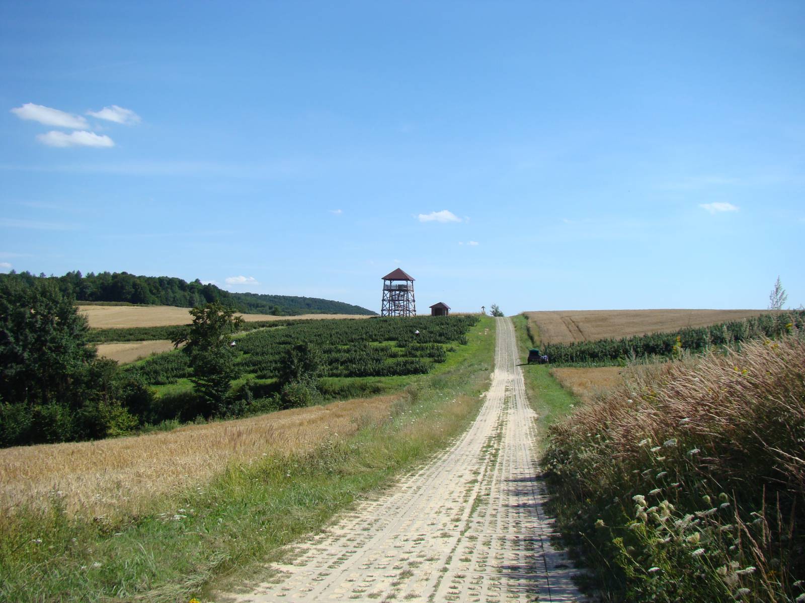
The Jastrzębia-Zdebrz Bike Trail is a real challenge for lovers of off-road cycling. The 75 km long route is very scenic and runs through one of the most beautiful parts of the entire Lublin region. Extensive landscapes, fairly good (when the weather is good) field and forest roads, paths and firebreaks that run along with nearly 1 kilometre of ascents and descents will give sheer pleasure to an experienced cyclist who is in good shape while covering this route. The greatest advantage of the route are the views offered by it, but we also encounter a lot of old, rural huts and charming wooden churches and quaint roadside shrines.
The general course of the trail is as follows: Biłgoraj (0.0 km) - Kąty (13.3 km) - Stara Wieś (17.0 km) - Radziecin (18.8 km) - Gródki (33.1 km) – Zalawcze (39.6 km) - Turobin (42.7 km) - Rokitów (45.3 km) - Gilów (52.5 km) - Hosznia Ordynacka (55.8 km) - Majdan Abramowski (58.8 km) - Jędrzejówka (60.4 km) km) - Teodorówka (66.0 km) - Wola Radziecka (69.8 km) - Trzesiny (75.0 km).
The route runs from the city of Biłgoraj northwards to the locality of Turobin, where it turns back to the south, reaching the village of Trzesiny. The trail is well signposted and conducted intuitively, although there are no signs on the forks of field roads in a few places. To cover the trail, you need to devote all day (at least 10 hours) and take an adequate amount of supplies, water and equipment. You can also divide the trip into two days, which is, due to the beauty of the area and the difficult nature of the trail, quite a reasonable idea. Then, you can find accommodation in one of the nearby agrotourism lodgings. However, there are not too many of them here, so it's worth searching for your accommodation beforehand.
The first part of the route, from the city of Biłgoraj to the village of Wola Kątecka, runs for about 10 km gently uphill through the vast, compact forests of the Sandomierz Wilderness. This fragment of the route runs mainly through forest paths, and on the way there are numerous swamps and backwaters.
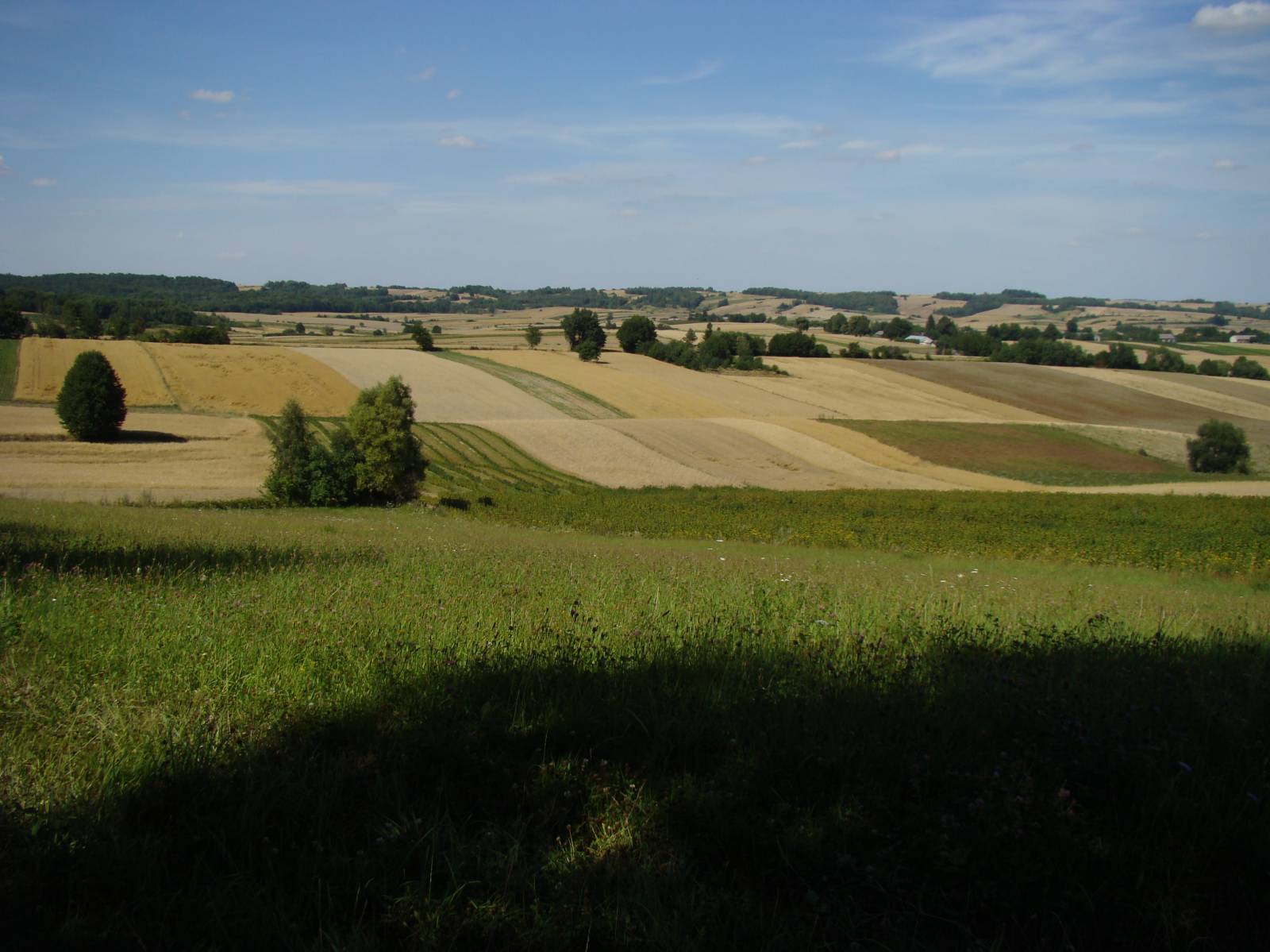
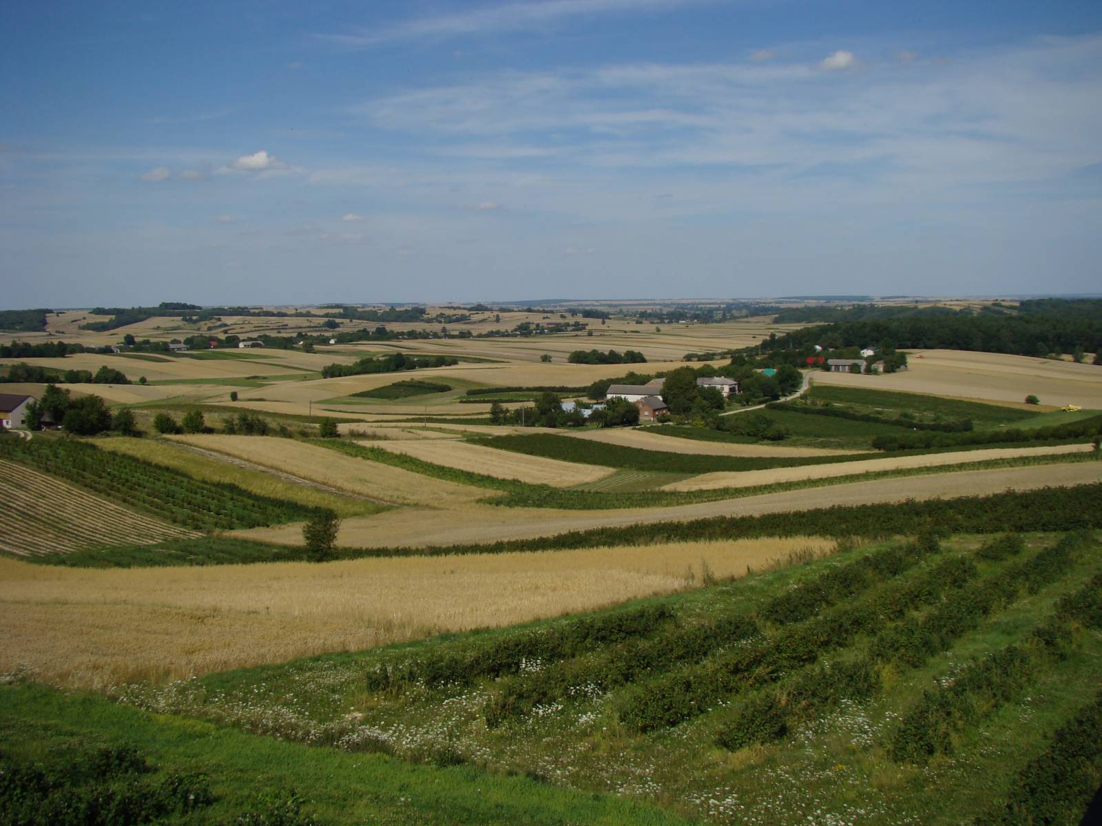
The second part of the route, between the villages of Wola Kątecka and Turobin, is completely different in its nature. The route, passing from the east near the locality of Frampol, climbs up to consecutive hills, offering cyclists unforgettable views. Cultivated fields, interlayered with forest ranges, wave up to the horizon, and hills slowly come into focus. A beautiful, agricultural landscape is one of the most beautiful in the Roztocze Region. Although all the time there are ascents and descents through numerous ravines, we ride north on the ridge of a massive hill. This makes it easier to overcome hills and provides excellent views.
The trail reaches the edge of the hills behind the village of Gródki. From this place, to the valley of the Por river, near the village of Turobin, we have a 100 metre difference in height over a distance of 2 kilometres. Northwards, however, luckily there is a descent. A further part of the trail runs for about 10 km in the valley of this small river, and the trail runs to a small locality of Turobin, where you can rest and replenish supplies of food and drinks. There are also several religious monuments here. It's roughly half of the total route.
From the locality of Turobin the trail returns to the south, running again to the Roztocze hills and towards the Biłgoraj Forests. Consequently you can see familiar hills, but from a different perspective. From the level of the Por river valley, the route ascents by about 100 meters. This time, however, it is much harder, as you have to cross successive ridges and elevations, having to overcome several solid ascents and descents. On one of the hills, in the locality of Hosznia Ordynacka, there is a vantage point. The summit is best place from which to admire the landscape of "Little Switzerland", as this area is sometimes referred to. Changes in elevation and hills continue almost all the way to the finishing point of the route in the village of Trzesiny.
The trail ends in this village. It should be remembered, however, that along with the return to Biłgoraj (e.g. the yellow “Wzgórze Polak” Trail), the distance covered by the cyclist will be over 100 km. In combination with the difficulty of the route, to cover such distance in one day is really a big effort.
Points of interest along the trail:
- Biłgoraj - religious monuments, a town located in the Polish Eastern Borderlands
- The Biłgoraj Forests (start of the route - about 10 km of a dense forest complex)
- Vantage point in the locality of Hosznia Ordynacka
- Landscapes of the Roztocze region hills
- Traditional rural construction (huts, shrines)
Not all fragments of the trail are suitable for bicycles with panniers/bike trailers. The trail runs without road traffic, only safe cycling through public roads, separate bike trails and roads without road traffic, dirt roads, forest roads and others. A trail for lovers of mountain biking and off-road cycling. Trail with outstanding natural beauty. Trail offering outstanding vistas.
Starting point:
Biłgoraj, Wolności Square, the market square
Finishing point:
Trzęsiny, intersection in the centre of the village