
 Highest point
 Lowest point
 Sum of driveways
 Sum of downhill
 Connected with GreenVelo
 Slope
Slope Marking
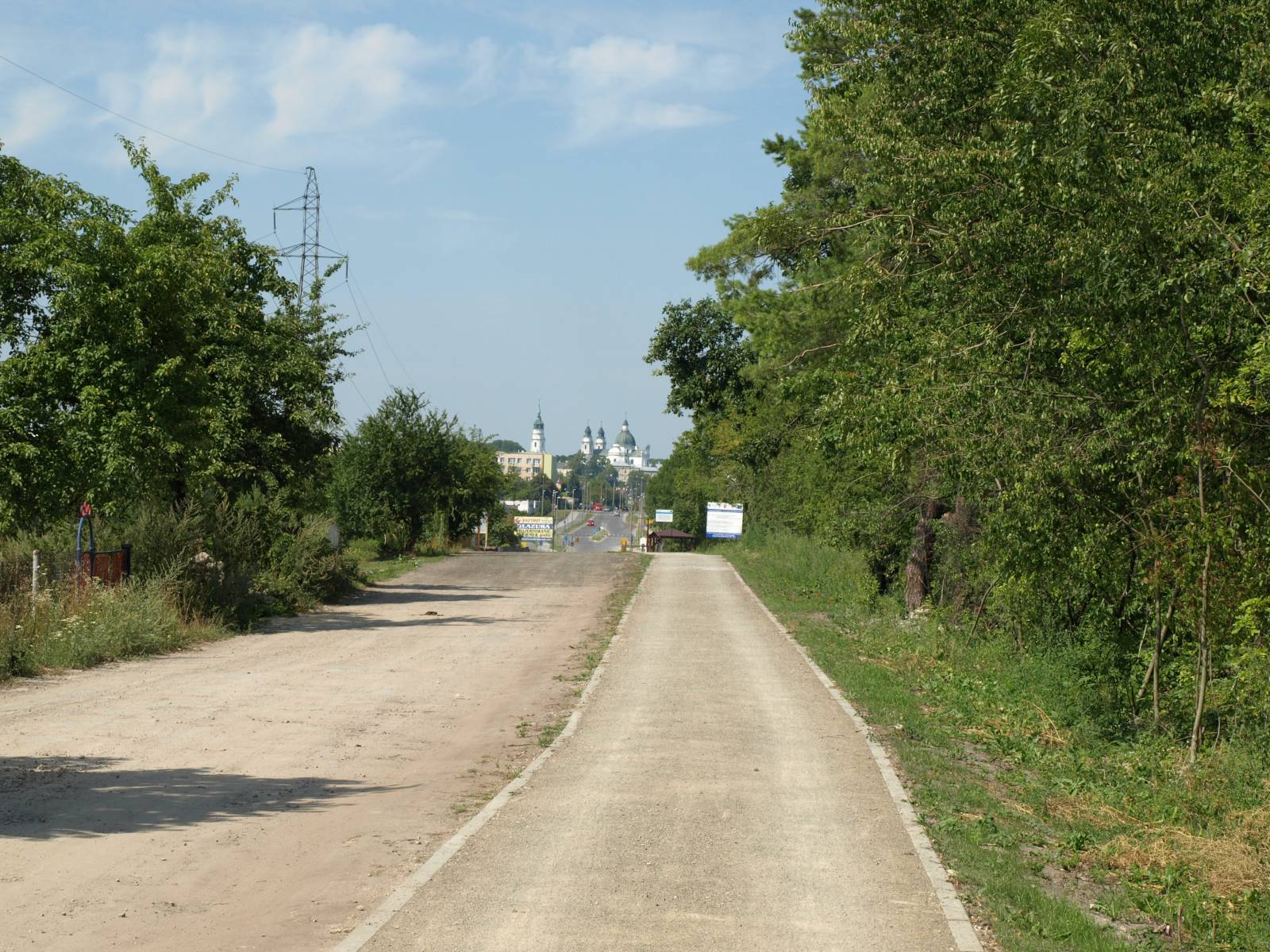
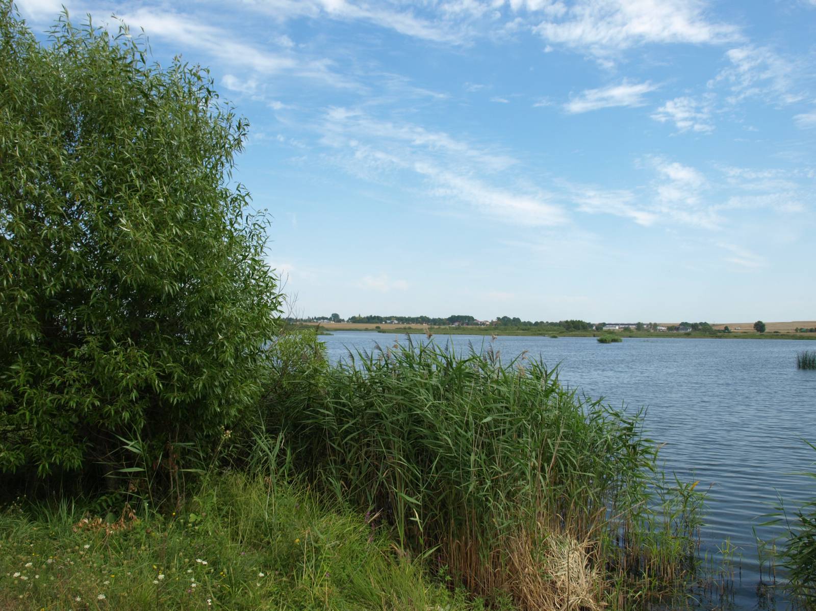
The trail, in accordance with its name, allows you to become familiar with the wavy and scenic landscape of Pagóry Chełmskie (Chełm Hills), situated to the south of the city. Although it spans more than 30 kilometres, the cyclist will not get more than 10 km away from the white towers of the churches on Górka Chełmska. Thanks to this, he or she will have more than one opportunity to admire the panorama of the city, dominating the wavy farmland sprawling in all directions. The trail is particularly picturesque in early summer, before the harvest. Riding it will then be like crossing the fields of gold, as in Sting’s famous song. Of course, it will be the gold of wheat and other crops grown in the area for centuries. They give excellent yields, seeing as the loess soil around Chełm is extremely fertile. The trail offers vast views, and as for resting along the route, you can go for a swim in the Żółtańce artificial lake, which is a designated swimming area on the Uherka River. The terrain on the trail is undulating, but there are no significant climbs or descents, thanks to which the route is also accessible for less seasoned cyclists. The advantage of the trail is that for the most part it relies on paved roads with little traffic or dirt roads. The latter can have the disadvantage of becoming less convenient following heavy rainfall, due to the clay-like character of loess. In such weather, it is recommended to pursue other trails rather than this particular one. Portions of the route go together with a Green Velo trail. The trail itself, however, is rather poorly and incompletely marked. Undertaking it without a map or a GPS track can be a serious problem, as it abounds in unmarked intersections of dirt paths without points of reference, thus making it easy to get lost.
The general route of the trail is as follows: Chełm, provincial road no. 812 (0.0 km) - Żółtańce, swimming beach (12.3 km) - Depułtycze Nowe (20.1 km) - Depułtycze Królewskie (21.7 km) - Pokrówka (26.1) - Strupin Łanowy (28.6 km) - Chełm, Bazylany (32.2 km).
The trail begins and ends in the southern outskirts of Chełm. One of the starting points of the trail is located along a Green Velo trail at the Bazylany MOR (short for Miejsce Obsługi Rowerzystów – Cyclist Service Area). This is the area of a former village. Today a part of it is located within the city limits. In the 19th century, in the area of the Borek forest, there was a military shooting range here and a cemetery where Russian soldiers were buried. It was also used during World War I. At that time, Polish, Austrian, German and Russian soldiers killed in the fighting which took place in the area would all be interred here. In the interwar period, Polish soldiers were buried here, and during the Second World War the cemetery became the burial place of Polish, German and Soviet troops. The trail features individual tourist attractions, such as the wooden church in Stare Depułtycze and the already mentioned Żółtańce artificial lake on the Uherka River. The biggest charm of the route, however, comes from the panoramic views of the Chełm Hills farmland, with church towers visible on the horizon. The other end (or beginning) of the trail is located at the Church of the Holy Trinity, situated on the Janówka River, by provincial road no. 812 going towards the town of Rejowiec.
Points of interest along the trail:
- Military cemetery near the Bazylany MOR in Chełm
- Wooden church in Stare Depułtycze
- Żółtańce artificial lake
- Distant views of the city of Chełm
The entire trail is suitable for bicycles with panniers/bike trailers. The trail uses solely roads with no motor vehicle traffic allowed or local roads with a low and very low vehicle traffic; no dangerous intersections. Recreational character.
Starting point:
Chełm, Chełm-Bazylany MOR, near the military cemetery
Finishing point:
Chełm, prov. road no. 812 (corner of Majdan and Zawadówka streets by the Holy Trinity Church)